
Civil Measurement Instrument

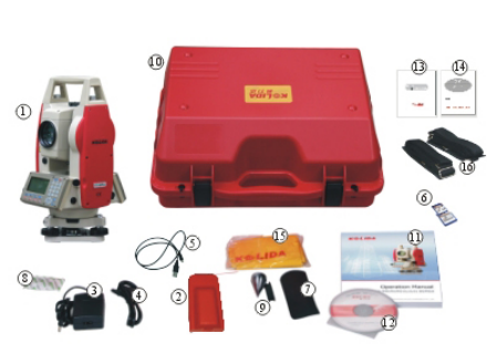
- Mainframe 1x
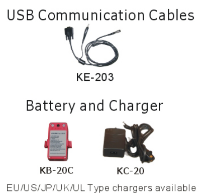
- Rechargeable Battery 2x
- Battery Charger 1x
- Communication Cable 1x
- Mini USB Cable 1x
- SD Card 1x
- Tools Kit 1x
- Dryer 1x
- Plummet 1x
- Carrying Case 1x
- Operation Manual 1x
- Software CD 1x
- Warranty Card 1x
- QC Pass Certificate 1x
- Rain Cover 1x
- Belt for Case 2x
|
KTS-442R6C |
|
| Measuring Ranger | |
| 1P |
5.0km |
| 3P |
8-10 km |
| Mini prism |
800m |
| Non prism |
600m |
| Digital Display |
Maximum: 9999 9999.9999 Minimum: 0.1 mm |
| Accuracy | With prism: 2 mm+2ppm Without Prism: 5mm+3ppm(only on 442/445rc) |
| Measuring Time |
Fine 1.0s Tracking0.5s |
| Atmospheric Correction |
Automatic Correction by Inputting Parameter |
| Prism Constant |
Automatic Correction by Inputting Parameter |
|
Angle Measurement |
|
| Measurement Method |
Absolute Encoding |
|
Diameter of The Raster Disk 79mm |
|
|
Minimum Reading 1”/5” Optional |
|
| Accuracy |
2” |
|
Detection Method Horizontal: Dual Vertical: Dual |
|
|
Telescope |
|
| Image |
Erect |
| Length |
154mm |
| Effective Aperture |
45mm,(DTM: 50mm) |
| Magnification |
30 X |
| Field of View |
1° 30’ |
| Resolving Power |
3” |
| Minimum Focus |
1m |
|
Compensation |
|
| System |
Dual axis liquid-electric |
| Working Range |
-3’ -- +3’ |
| Resolving Power |
1” |
| Sensitivity of Vials | |
| Plate Vial |
30” /2mm |
| Circular Vial |
8’ /2mm |
|
Optical Plummet |
|
| Image |
Erect |
| Magnification |
3 X |
| Focusing Range |
>0.5m |
| Field of View |
5 |
|
Data Storage & Communication |
|
| Internal Memory |
2M/24000 points |
| External Memory |
SD card(up to 2G), only available with442R |
| Communication Port |
RS-232, mini USB |
|
Display |
|
| Type |
Dual side, 6 lines |
|
Battery |
|
| Power Supply |
Rechargeable Ni-H battery |
| Voltage |
6 V DC |
| Operation Time |
10 hours |
|
Dimension & Weight |
|
| Dimension |
160mm*150mm*330mm |
| Weight |
5.8kg |
|
Environmental Specification |
|
| Dust/Water(IEC60529) IP55 | |
|
Working Temperature Range -20℃~50℃ |
|
|
Humidity 95%, non-condensing |
|
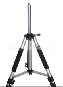
Levels
Code: GLXDL -2003 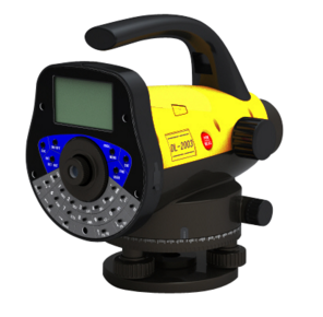
 Main features
1. More Advanced Compensator DL-2003 Digital Levels are made by KOLIDA Total Station factory. Their compensators are more advanced than optical levels, and make the standard 1km double run leveling accuracy reached 0.3mm. Meanwhile, their stability and reliability against the physical and magnetic impacts have also been enhanced. 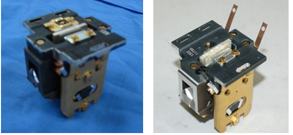
Compensator for DL-2003
Compensator for Optical Levels
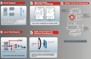
2.Highly Integrated Design Only one board! Electronic imaging resolution circuit is integrated with CCD circuit, which makes it much easier to maintenance. Multiple protections have been made to protect the sensitive spare parts. 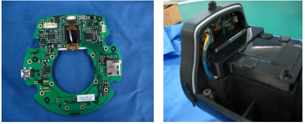
3. Various Survey Programs 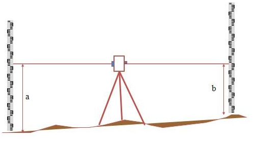 a. Line measurement
b. Automatic collimation correction
c. Automatic calculation.
(Including elevation difference, accumulated elevation difference, accumulated collimation error and accumulated range of visibility and other elevation surveying.)
d. Automatic stake out.
(Automatic stake out for distance, elevation and elevation difference, which can be widely used in class II, class III, and Class IV leveling survey, and settlement observation.)
e. Measuring Hydrological fulcrum
f. Set error limit.
(Automatically detect the elevation difference and collimation error, and alert when error exceeds the limit.)
g. Freely name and note for the surveying points.
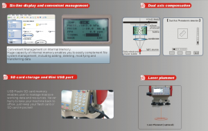
4.Humanized Design a.160*96 LCD, 8 Lines display, with numeric and alphabetical keyboard makes it much easier to input and process data. b. Automatic reading. No misreading and no error record. c. High precision. 0.3mm precision and auto average the multiple reading d. High speed. Spend half the time than the traditional instrument. e. High efficiency. Support abundant software for automatic adjustment, indoor and outdoor processing. Support detail survey, profile survey and so on. f. Easy storage. Surveying data can be storage in SD card or internal memory card, and easily output to computer through USB port.
5. Wide application  a. Topographic survey: detail survey, regional survey, contour line survey, and control point survey.
b. Road, railway, building construction survey: cross-section leveling, elevation control, slope control, road ware down survey, monitoring survey, and so on.
c. Pipeline construction, channel construction survey: pipeline positioning, slope control, gap survey.
d. Deformation monitoring: settlement survey, loading survey.
e. Industrial Survey: Machine survey, base surface survey, foundation survey, rotating turret survey.
| Model Specification | GLXDL-2003 | |
| Height Accuracy(Standard Deviation For 1km Double Run Leveling) | Digital Reading | 0.3mm |
| Optic Reading | 1.0mm | |
| Distance Accuracy | Digital Reading | D≤10m:10mm D≥10m:D*0.001 |
| Distance Range | Digital Reading | 1.8m~105m |
| Minimum Display | HD | 0.1mm/0.01mm |
| Distance | 0.1/1cm | |
| Measuring Time | Within 3s in Normal Condition | |
|
Telescope |
Magnification | 32x |
| Resolving | 3” | |
| Field Of View | 1° 20’ | |
| Multi-Constant | 100 | |
| Add-Constant | 0 | |
|
Compensator |
Type | Magnetic-Damped |
| Range | >±12’ | |
| Accuracy | 0.20” /1’ | |
|
Data Storage |
Storage | 16MB |
| Point Name | Increasing/Decreasing/User-Defined | |
| Connection | USB | |
| External | SD Card | |
| Circular Vial Accuracy | 8’ /2mm | |
| Auto Power Off | 5 minutes/OFF | |
| Horizontal Dial | 1° | |
| Display | LCD Display of 160*64 dpi With illuminator | |
| Working Temperature | -20℃~50℃ | |
| Dimension | 230mm*150mm*210mm | |
| Weight | 2.5kg | |
GNSS

 ▪ 220 channels, Pacific Crest GNSS Motherboard, support GPS/GLONASS/Galileo/BeiDou
▪ Built-in Transreceiver Radio with 1-4 km emitting range
▪ Built-in GPRS (3G optional) modem and UHF data link
▪ Compatible with major brands GPS/GNSS receivers
▪ Small, lightweight and rugged design for demanding environment field work
▪ 4G Internal Memory Space
|
Satellite Signal Tracked Simultaneously |
| GPS: L1C/A,L1C,L2C, L2E, L5 |
| GLONASS: L1C/A, L1P, L2C/A, L2P, L3 |
| SBAS: WAAS, EGNOS, MSAS |
| Galileo: E1, E5A, E5B (test) |
|
Positioning Accuracy |
| Real Time Kinematic (RTK): Horizontal: 8mm+1ppm RMS Vertical: 15mm+1ppm RMS Initialization time: typically<8s Initialization reliability : typically >99.9% |
| Static Surveying (Post-processing) Horizontal: 3mm+0.5ppm RMS Vertical: 5mm+0.5ppm RMS Baseline Length: ≤300km |
|
Communication & Data Storage |
| Standard USB 2.0 Port RS-232 Port: Baud rate up to 115200 Integrated Bluetooth ® Class 2 Integrated Trans-receiver Radio 410-430/ 430-450/ 450-470 Mhz Internal Radio Working Range: 1-4 km External Radio Working Range: 15-20km |
| Data Storage: Internal Memory 4GB Update Rate: 1Hz, 2Hz, 5Hz, 10Hz, 20Hz, 50Hz positioning output. Reference Output: CMR, CMR+, RTCM2.1, RTCM2.2, RTCM2.3, RTCM3.0, RTCM3.1 |
|
Physical & Environmental |
| Dimension(LxWxH): 205mmx 205mmx 100mm |
| Weight: 1.2kg (include all module and battery) Working Temp. : -45℃ to +60℃ Storage Temp. -55℃ to +85℃ Humidity: 100% condensing Water/ Dust Proof IP67 Shock and Vibration: designed to survive from a 2.5m drop onto concrete |
|
Electrical |
|
External Power Input: 12-15V DC (not less than 36Ah) Internal Battery Capacity: 2500mAh Internal Battery Life: 6-12 hours for 2 batteries |
